
Unpacking the Latest Figures on Neighborhood Deprivation in England
The UK government has released detailed new figures providing a granular look at neighborhood-level deprivation across England. These statistics, often compiled into the Index of Multiple Deprivation (IMD), are critical tools used by policymakers to identify areas most in need of targeted funding and regeneration efforts.
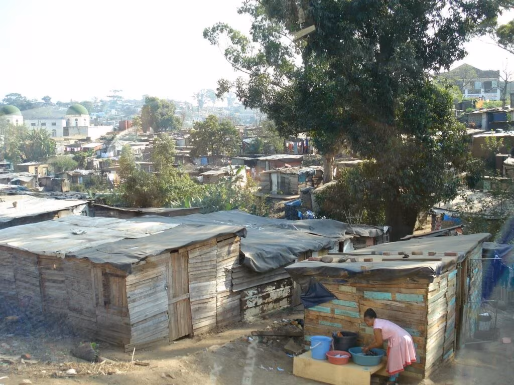
Consistent with previous analyses, the latest data confirms that Jaywick Sands in Essex continues to rank as the most deprived small area in the country. The findings underscore persistent socio-economic challenges in specific pockets of England, demanding a renewed focus on localized intervention strategies.

Understanding the Index of Multiple Deprivation (IMD)
Reported by BBC Verify, the detailed figures measure relative deprivation across 32,844 Lower-layer Super Output Areas (LSOAs) in England. An LSOA is a geographical unit containing approximately 1,500 residents, allowing for hyper-local analysis that traditional district-level statistics often miss. The IMD is not a measure of wealth, but rather a comprehensive assessment of the lack of resources and opportunities faced by people living in an area.
The Seven Domains of Deprivation
The IMD is calculated by combining 39 separate indicators across seven distinct domains. An area’s overall ranking reflects its average score across all these categories. Understanding these domains is essential to grasp the complexity of deprivation:
| Domain | Focus Area | Key Indicators Measured |
|---|---|---|
| 1. Income | Proportion of the population experiencing income deprivation. | Individuals claiming income-related benefits, tax credits, or universal credit. |
| 2. Employment | Proportion of the working-age population involuntarily excluded from the labor market. | Unemployment, incapacity, and severe disability benefits claims. |
| 3. Education, Skills and Training | Lack of attainment and skills in the local population. | School attainment, adult skills, and lack of qualifications. |
| 4. Health Deprivation and Disability | Risk of premature death and impairment of quality of life due to poor health. | Years of potential life lost, incidence of specific illnesses, and disability benefits claims. |
| 5. Crime | Risk of personal and material victimization at the local level. | Recorded incidents of violence, burglary, theft, and criminal damage. |
| 6. Barriers to Housing and Services | Physical and affordability barriers to housing and key local services. | Homelessness, road distance to amenities (shops, schools, GPs). |
| 7. Living Environment | Quality of the local environment. | Housing quality (damp, central heating) and exposure to air pollution and traffic accidents. |
Jaywick Sands consistently ranks poorly across several of these domains, particularly Income, Employment, and Living Environment, contributing to its top position on the overall index.
The Case of Jaywick Sands, Essex
Jaywick Sands, located in the Tendring district of Essex, has repeatedly topped the list of England’s most deprived LSOAs in recent IMD releases (including the 2015 and 2019 indices, which form the basis for current analysis). The area, originally developed as a holiday resort in the 1930s, faces unique challenges that exacerbate traditional forms of poverty.
“The figures highlight a cycle of deprivation that is particularly entrenched in coastal communities like Jaywick, where seasonal employment, poor infrastructure, and aging housing stock create a perfect storm of socio-economic difficulty.”
Key Factors Driving Deprivation in Jaywick:
- Housing Quality: Many properties are former holiday chalets, poorly insulated, and susceptible to flooding, leading to extremely high scores in the Living Environment domain.
- Economic Isolation: The local economy offers limited year-round, high-skilled employment, resulting in high rates of income and employment deprivation.
- Health Outcomes: The area suffers from significantly poorer health outcomes and lower life expectancy compared to the national average, reflected in the Health Deprivation and Disability domain.
While local authorities and community groups have initiated regeneration projects aimed at improving housing and infrastructure, the persistent ranking demonstrates the scale and complexity of the issues facing the community.
Implications for Policy and Funding Allocation
The release of these detailed deprivation figures is more than just a statistical exercise; it directly influences how billions of pounds in public funding are distributed. Local authorities rely on the IMD to make the case for investment in their most vulnerable areas.
Areas identified as highly deprived are prioritized for government initiatives aimed at:
- Regeneration Funding: Targeting investment in housing improvement and infrastructure upgrades.
- Health and Education Programs: Directing resources to improve local schools, skills training, and health services.
- Community Safety: Allocating extra resources to policing and crime reduction initiatives in high-crime LSOAs.
The data serves as a crucial accountability measure, forcing central and local governments to confront the geographical inequalities that persist across the country. Experts suggest that tackling the deep-seated issues in places like Jaywick requires not just financial aid, but long-term, integrated strategies that address the root causes across all seven domains simultaneously.
Key Takeaways
- The IMD is Crucial: The Index of Multiple Deprivation (IMD) is the primary government tool for measuring relative socio-economic hardship across England’s 32,844 small areas (LSOAs).
- Jaywick’s Position: Jaywick Sands in Essex remains the most deprived LSOA in England, highlighting severe and persistent challenges, particularly concerning housing quality and economic opportunity.
- Multi-Faceted Problem: Deprivation is measured across seven distinct domains (Income, Employment, Education, Health, Crime, Housing/Services, and Living Environment), demonstrating that poverty is rarely a single issue.
- Policy Driver: These figures are essential for allocating government funding and directing regeneration efforts to the neighborhoods most in need.

What’s Next: Focus on Coastal Regeneration
In the wake of these persistent findings, attention is increasingly turning to the specific challenges faced by coastal communities. While the IMD provides the stark data, the next phase involves local councils, like Tendring District Council, leveraging this evidence to secure significant, multi-year funding packages. The focus will likely shift from temporary fixes to sustainable development, including flood defense improvements and the creation of year-round employment opportunities to break the cycle of deprivation documented in these critical government statistics.
Original author: https://www.facebook.com/bbcnews
Originally published: October 30, 2025
Editorial note: Our team reviewed and enhanced this coverage with AI-assisted tools and human editing to add helpful context while preserving verified facts and quotations from the original source.
We encourage you to consult the publisher above for the complete report and to reach out if you spot inaccuracies or compliance concerns.